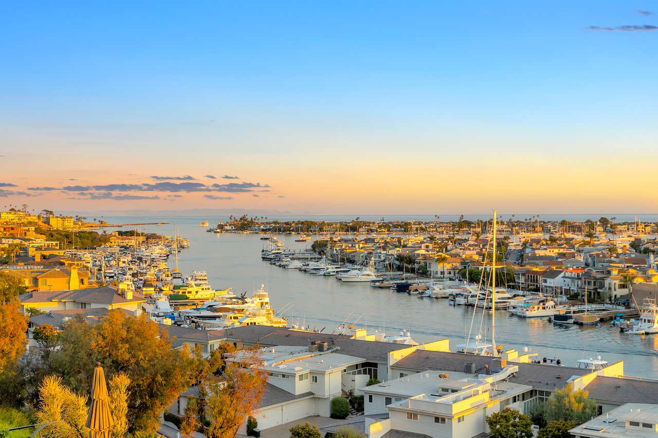
Walk down through the beach-key gate at low tide, past the rock shelf below Little Corona, and most people will tell you the same thing: you are standing in Crystal Cove. It is the easiest way to describe the whole stretch, from the sand below the neighborhood down toward Pelican Hill. Ask a longtime resident to name what they are actually looking at and the answer gets more specific, and more interesting.
The water directly off Cameo Shores is not Crystal Cove. It has its own name, its own history, and its own rules, and the two designations meet somewhere along the walk south in a way that changes what is and is not permitted depending on exactly where your feet are.
A Name Older Than the Signs Around It
The tide pools and near-shore waters fronting Little Corona and the northern reach of Cameo Shores Beach are designated the Robert E. Badham Marine Life Refuge, a boundary that runs between Poppy Avenue and Cameo Shores Road and extends roughly two hundred feet offshore. The refuge predates the modern marine protected area system built out under California's Marine Life Protection Act. It was originally known as the Newport Beach Marine Life Refuge, and the city still marks the entrance at the corner of Ocean Avenue and Poppy Avenue, the same access point divers and snorkelers have used for decades.
That means the pools closest to home, the ones a resident checks before deciding whether to walk the kids down at low tide, sit inside a refuge with its own signage and its own enforcement history, separate from the newer Crystal Cove designation to the south. Crystal Cove is the more recognizable name, but it is not the right name for the water closest to the neighborhood.
Two Refuges, Two Rulebooks
Keep walking south past Pelican Point and the ground rules shift again. Crystal Cove State Park's own neighborhood sits just below Cameo Shores, and the water offshore there falls under the Crystal Cove State Marine Conservation Area, one of four adjoining marine protected areas that together cover roughly fourteen square miles of coastline running down toward Dana Point. It was established in December 2010 as part of the state's South Coast expansion of protected waters.
The practical difference between the two zones comes down to what a licensed angler is allowed to take home.
| Zone | Covers | Recreational take |
|---|---|---|
| Robert E. Badham Marine Life Refuge | Poppy Avenue to Cameo Shores Road, roughly 200 feet offshore | No take of any kind from the tide pools |
| Crystal Cove State Marine Conservation Area | South of Pelican Point, part of a four-MPA cluster | Finfish by hook and line or spearfishing, lobster, and sea urchin permitted with a valid license; tide pools remain no-take |
Both zones prohibit picking up a shell, a rock, or a creature from the tide pools themselves. That rule does not change as you cross the line. What changes is open-water fishing. A few hundred yards south of the neighborhood's own beach, a licensed angler can legally spearfish or take lobster in a way that would violate the refuge rules if attempted from Little Corona.
Crystal Cove State Park puts the collecting rule plainly on its own visitor guidance:
Never collect shells, rocks or organisms from the tidepools.
That instruction holds everywhere between Poppy Avenue and Pelican Hill, refuge or conservation area. It is the one rule that does not care which side of the boundary you are standing on.
The Season Is About to Flip the Clock
There is a second shift happening right now, and it has nothing to do with jurisdiction. Crystal Cove's own tide guidance notes that the best tide pooling happens during a negative low tide, and the timing of those negative lows moves with the calendar. In spring, the deepest lows tend to land early in the morning. By late fall and winter, that same negative low tide shifts into the afternoon.
Late August sits right at the hinge. Residents who spent the summer checking a pre-dawn tide chart out of habit are about to find that habit works against them. The window worth planning around is moving toward midday and afternoon as autumn sets in, which also happens to be a more comfortable time of day to walk the rocks with kids than a 6 a.m. low tide in June.
Where the Sand Runs Out
The walk itself has landmarks that mark the transition even without a map. Arch Rock sits offshore to the south of Little Corona, a pyramid-shaped formation that is easy to spot from the bluff and a reasonable point to judge how far the tide has pulled back. Beyond it, past the rockier shoreline that eventually opens onto Cameo Shores Beach itself, sits Cliff Island and its Ocean Arch, a natural rock formation that becomes a local swimming spot in summer when the tide allows it.
Keep going and the coastline eventually delivers you into Crystal Cove State Park proper, where the park designates four separate tide pool viewing areas: Reef Point, Rocky Bight, Pelican Point, and Treasure Cove. Each has its own access point and its own parking arrangement inside the park. For anyone paddling that stretch rather than walking it, the state park permits kayak launching only in specific segments, from Moro Cove to Muddy Creek, and from the south end of the park's Historic District to the north end of Treasure Cove. Launch or land outside those windows and you are technically outside the permitted zone, refuge rules aside.
None of this requires a permit to know. It requires knowing which name applies to which stretch of water, which is a useful distinction when exploring the coastline.
A Neighborhood Social Calendar
The tide pools are not the only thing in Cameo Shores that runs on its own schedule. The neighborhood is organized under the Cameo Community Association, and residents who have served on its board describe a social calendar built around beach parties and standing committees, including one with an unusual name for a homeowners association: the Cameo Philharmonic Committee. It is the kind of detail that does not show up on a map or a tide chart, but it says something about a neighborhood small enough that a committee named for a symphony can become a fixture of daily life rather than a footnote.
That is really the pattern running through all of this. Cameo Shores looks, from the outside, like one continuous stretch of private coastline. Walk it enough times and the lines start to show. A refuge with a name most visitors never learn. A conservation area with its own take limits. A tide clock that quietly resets itself every autumn. A homeowners association with a committee named after an orchestra. None of it is hidden exactly. It is just the kind of detail that only shows up once you have made the walk often enough to notice where one thing ends and the next one begins.
If you are weighing a move into this stretch of the coast, or already live here and want a clearer sense of what makes a Cameo Shores address hold its value, Casey Lesher can walk you through the neighborhood in the same detail. Request a confidential market consultation to talk through what a home on this stretch of coastline is actually worth, and what makes it worth it.
This article is general information, not legal, tax or financial advice. Consult a qualified professional about your situation.